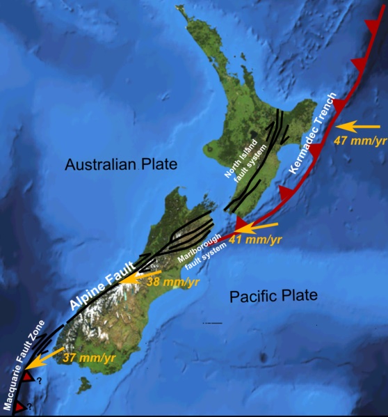
The Alpine Fault runs along the western side of New Zealand's South Island. The Pacific Plate (east) slides past the Australian Plate (west) at about 38 mm per year, a transform boundary. The yellow arrows show the Pacific Plate's motion relative to the Australian Plate; the rate increases northward, where motion is taken up by the Marlborough fault system on land and then by subduction at the Kermadec Trench off the North Island. Christchurch sits on the east coast, well east of the Alpine Fault but within the same wider plate boundary zone. Map: Mike Norton, Wikimedia Commons.
Move south-east. About 2,000 km south-east of the Tonga-Kermadec Trench, the same two plates meet again, but this time they do something completely different. The Alpine FaultA 600-km-long fault running along the western side of New Zealand's South Island. It is the main plate boundary between the Pacific and Australian Plates in this region, dominantly strike-slip (the plates slide past each other horizontally). is where the Pacific and Australian Plates slide past one another, not into one another. The plates are the same ones you met at Tonga, but the boundary type here is transformA plate boundary where two plates slide past each other horizontally. No crust is created or destroyed at a pure transform boundary. The motion is sideways, parallel to the fault line., not convergent. Apply what you know to a different kind of boundary.
The situation at the Alpine Fault
Now apply what you know.
Here's what's true at this specific boundary:
→
The same two plates meet here, but with different crust. The Pacific Plate (east) and the Australian Plate (west), exactly the same pair you met at Tonga. At this location, though, both plates carry continental crustThe crust under continents. Made of lighter rock (mostly granite). Thicker and less dense than oceanic crust. The rocks of New Zealand's South Island are continental crust on both sides of the Alpine Fault.: the rocks of New Zealand's South Island. The same plate can carry both kinds of crust in different places.
⇄
They slide past each other, not into or apart. The Australian Plate moves to the north-east relative to the Pacific Plate (the Tasman and West Coast regions are heading north, while Canterbury and Otago are effectively heading south). This is a strike-slipA type of fault where the two sides slide horizontally past each other, parallel to the fault line. Strike-slip motion is the dominant motion at transform plate boundaries. or transform boundary. No plate is being destroyed (as at Tonga) or created. The motion is mostly horizontal, like two cars scraping past one another.
⏱
The motion is slow but never stops. About 30 mm/yr on average, roughly one-eighth the speed at the Tonga-Kermadec Trench. But the plates do not slip smoothly. Friction locks them together, stress builds up over decades to centuries, and when the rock finally fails, it fails suddenly, in an earthquake.
Take a moment. With what you now know about plates and the different ways they can meet, what do you reckon happens at a boundary where they slide past each other instead of crashing together?
Step 1: Predict
What do you think will happen at this boundary?
Try starting: "I think this because…"
Choose an option above and write at least 5 characters of reasoning.
What a scientist would predict
You predictedYour reasoning
The Alpine Fault is a transform boundary, so the prediction is that the two plates slide past each other horizontally. The Australian Plate moves to the north-east and the Pacific Plate moves to the south-west, scraping along the fault line. No new crust forms; no crust is destroyed. Friction along the fault locks the plates together, and when the rock finally fails it releases the stored energy as an earthquake.
If you picked "plates pull apart and new crust forms": that is correct for the Southeast Indian Ridge (Case 4) but not here. No new crust is being made along the Alpine Fault, and the boundary runs on land, not under the ocean. Hold onto that prediction for the next case.
If you picked "one plate slides under the other": that is correct for Sunda (Case 1) and Tonga (Case 2) but not here. South Island has continental crust on both sides of the Alpine Fault, and there is no trench, no volcanic arc, and no deep subduction zone. The plates are too buoyant (and the geometry wrong) for either side to be forced down.
Predictions are not graded. The point was to commit to a guess before watching the animation, so that what you see next has something to push against.
Step 2: Observe
Watch what actually happens.
Time scale: roughly 10,000 years of fault motion compressed into 6 seconds. Displacement exaggerated for clarity.
At the Alpine Fault, the two plates do not push into one another. They slide past, carrying the land with them. Features that once crossed the fault in a straight line (rivers, roads, even fence lines) get progressively offset over time. The plates do not slip smoothly: friction locks them together, stress builds up in the rocks for decades to centuries, and then the fault breaks suddenly in an earthquake, releasing the stored energy. The Alpine Fault has been doing this for roughly 25 million years, accumulating about 480 km of total horizontal offset and uplifting the Southern Alps along the way.
Seeing the real Alpine Fault
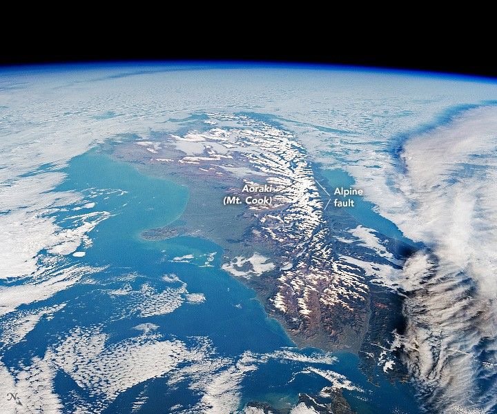
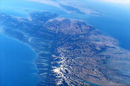
Transform faults like this one cut visible lines across the landscape. Subduction zones (like Tonga's) sit hidden under the ocean. The Alpine Fault is one of the clearest plate boundaries on Earth to see from above.
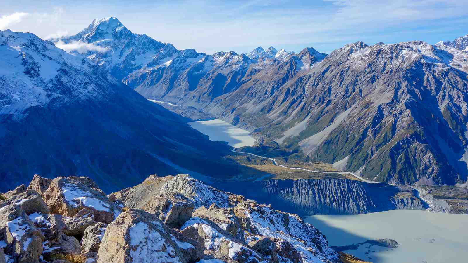
From space. The Alpine Fault appears as a clear line along the western edge of the Southern Alps. Source: NASA / ISS.From the air. The Southern Alps rise abruptly on the eastern side of the fault. Source: NASA.On the ground. Aoraki / Mt Cook (3,724 m) viewed from above Sealy Tarns, in the head of the Hooker Valley. Mueller Glacier moraine and its terminal lake fill the valley floor. The Southern Alps have been uplifted along the Alpine Fault for the past ~12 million years; this is the kind of country that 12 million years of vertical motion builds. Source: Watchers.News (2015), likely original photograph by Rob Suisted (naturespic.com), used with permission or under fair use for educational purposes.
Step 3: Explain
Now make sense of what you saw.
Try starting: "My prediction was… What I actually saw was… This means that…"
Write at least 15 characters to enable Submit (0/15).
Here's one way to explain this
Your explanation
At the Alpine Fault, the two plates slide past each other horizontally instead of pushing together or pulling apart. The Australian Plate moves to the north-east; the Pacific Plate moves to the south-west. Friction along the fault locks the plates together, so the motion is not smooth: stress builds up in the rocks for decades or centuries, and then the fault breaks suddenly, releasing the stored energy as an earthquake. This is why the Alpine Fault region experiences large earthquakes even though there is no subduction zone and no volcanism.
What makes a strong answer here:
Identifies the boundary as transform (or strike-slip): the plates slide past each other.
States the relative motion (which plate moves which way, or just "horizontal sliding parallel to the fault").
Explains why earthquakes happen here: friction locks the plates, stress builds up, the rock fails suddenly.
Distinguishes this from subduction (Tonga, Sunda) or divergence (Southeast Indian Ridge) by saying what is not happening.
This is one possible way to express the explanation, not the only correct answer. If your wording is different but you covered the same key ideas, you have it. The point of this step is to put the mechanism into your own words and then check that against a model.
Why this matters
The Christchurch earthquake (22 February 2011) happened here.
At 12:51 pm on Tuesday 22 February 2011, a magnitude 6.3 earthquake struck Christchurch. The focus was only 5 km below the surface, near the suburb of Lyttelton, just 10 km south-east of the central city. Although smaller than the magnitude 7.1 earthquake that had shaken the region five months earlier, the February quake was far more destructive: it was shallow, close to the city, and it struck during lunchtime when streets and buildings were full.
One hundred and eighty-five people died. The deadliest single collapse was the six-storey CTV building in the central city, which fell in seconds and killed 115 people. Another 18 died in the Pyne Gould Corporation building. Across the city, water-saturated soil turned to liquid in a process called liquefactionA process where wet, loose soil temporarily behaves like a liquid during strong shaking. The ground loses its strength and can no longer support buildings, roads, or pipes., wrecking foundations and splitting roads. Total damage was later estimated at around $40 billion (NZD).
This earthquake did not happen on the Alpine Fault itself. It happened on a smaller, previously unmapped fault east of the main plate boundary. But the energy came from the same place: the Pacific and Australian Plates grinding past each other. That same motion stresses a whole network of related faults across the South Island, and any of them can rupture. The Alpine Fault itself last had a major earthquake in 1717. Its big ruptures happen on average every 250 to 300 years, and scientists estimate a roughly three-in-four chance of another one within the next 50 years. When it goes, it will be far larger than Christchurch 2011. The plates have not stopped moving. The next major earthquake is a question of when, not whether.
Up next →South-west: The Southeast Indian RidgeContinue